
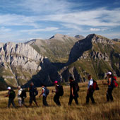
…The people coming from Tetovo have always thought of Šar Planina as their pride, and the mountain’s abundance in natural resources and its diversity filled their hearts with joy and reminded them of how wonderful the life is and how happy they are having the mountain by their side...
Branislav Svetozarevikj
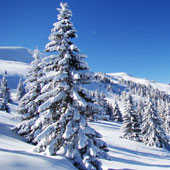
Šar Planina
The mountain amazes with its grandiose beauty and its size and astonishing diversity attracts everyone’s attention.
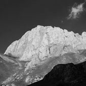
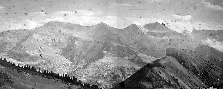
Šar Planina belongs to the Scardo-Pindic Mountain chain. It is situated in the furthest northwestern part of the Republic of Macedonia and it stretches from southwest to northeast. The mountain extends from the river Lepenec, id est the peak of Ljuboten (2499 m), to the peak of Morava (2147 m), id est the upper flow of river Radika and the northern part of lake Mavrovo. On the southeast borders with Polog Valley, whereas on the northeast, north, northwest and southwest it borders with Kachanik Gorge, Sirinich region, the valley of the river Prizren Bistrica, Gorska and Opoljska region, Kalabaka and Sherupa.Šar Planina is characterized by considerably broad ridge, which by a horizontal projection is 76 km long, with an area of 1600 km². The average height of the mountain ridge is 2200 m.
Šar Planina is best described by Dushan Krivokapikj, who is considered to be the mountain’s most passionate writer, in his work called “Šar Planina – touristic and geographical review of the region and its people”.
...After reaching the depths of Šar Planina, you suddenly become aware of its impressive complex of high-mountain wilderness and montane tameness; on one hand, the mountain is a wilderness that impose its natural laws even to the most experienced mountaineer, forcing him to overthink his steps, whereas on the other, it is a monate tameness suitable even for a child’s temper and playfulness. Such is Šar Planina...
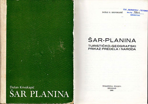
Šar Planina - Dushan Krivokapikj, 1969
First research expeditions on Šar Planina
Such as it is, Šar Planina first attracts the attention of the local inhabitants for economic reasons. However, the real interest in the mountain was shown as a result of the arrival of foreign scientists, adventurers and mountaineers. There are many records for the first research expedition on Šar Planina, dating back from the second half of the 19th century. These expeditions were mostly performed by geologists and botanists due to mountain’s diverse flora and fauna. Apart from the scientific needs, Šar Planina is a target for performing military studies due to its geostrategic location. The first researchers of Šar Planina were the French geologists Ami Boué and A. Vikenel, who in 1838 reached the peak Kobilica and descended through Struzhje in Prizren.
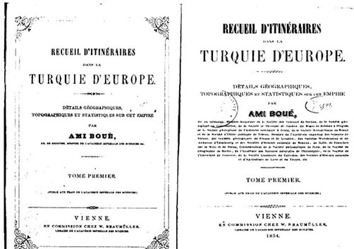
European Turkey – Ami Boué, Vienna, 1854
In July next year, the German botanist Grisebach, led by a Turkish officer and accompanied by nine local inhabitants and one soldier, climbed the peak of Ljuboten through the village Staro Selo. The same month, Grisebach also climbed Kobilica. In the middle of 19th century, the Austrian scientist Neumayer with his companion Burgerstein climbed the peak of Ljuboten under extremely bad weather conditions. In 1877, Šar Planina “hosted” experts from the Military-Geographical Institute of Vienna.
In August 1890, the Serbian anthropologist Jovan Žujović organized scientific excursions on Šar Planina Jovan Žujović, accompanied by Jevrem Žujović, Jovan Cvijić and Dragutin Petrović, climbed Ljuboten through Kachanik Gorge. The same year, the botanist Derfler climbed the peak of Kobilica, and two years later the botanist Wettstein did the same. In September 1898, Estreich and his companion Vigandom climbed Ljuboten, while in Ocotober, Estreich climbed Kobilica once again, all by himself. In 1990, the geologist Vladimir Petrović reached the peak of Ljuboten, and two years later, accompanied by the inspector Oscar Birbach from the botanical garden in Belgrade, Petrović climbed Ljuboten once again. In 1910, Jovan Cvijić and Rista Nikolić descended from Tetovo to Prizren through Šar. In 1911, Rista Nikolić and the botanist Nedeljko Koshanin crossed the route Ljuboten-Džini Beg; the trip lasted nine days (from 19th to 27th June). In August 1917, a group of six German scientists led by the German zoologist Franz Dofflein, that time officers serving in Skopje, stayed one week on Kobilica.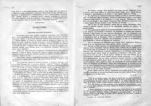
“Гласник на СГД”, turistika, Šar Planina - Rista Nikolić, 1912
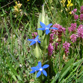
Ever since the 19th century, there were people who showed interest in Šar Planina . Šar Planina is one of the most important mountains of the Balkan Peninsula due to its natural resources, such as the glacial lakes, huge pasture teinsrr, diverse flora and fauna, as well as its economic and political character. Although Šar Planina was always considered to have a great potential in the fields of biology, geology, economy and tourism, there wasn’t any possibility for this potential to be developed.
Shar Planina’s mountaineering
This text is about more recent history of the people who began hiking on Šar Planina, not for economic reasons, but out of curiosity and desire to dive into nature and escape from the daily routine. People wanted to explore Šar Planina’s natural resources ever since the 19th century, when it was completely impossible. However, there are records of accidental visits of Šara even during that period. According to some stories from the 19th century, a group of merchants and stockbreeders from Tetovo, occasionally accompanied by sejmens (type of policemen), climbed the peak of Ljuboten, which was thought to be the highest peak of Šar Planina at that time, the peak of Piribeg, Crn Vrv, Karanikola, Mal and Golem Turchin and some other peaks. These clambers were considered as great achievements and advantures and were retold from generation to generation. In 1887 in Tetovo, there was a school for apprentices led by Andreja Stojanov, that organized excursions to Šara so that the pupils could get acquainted with the nature and enjoy it.
Banjiche – 1907
At the beginning of the 20th century, the organized mountaineering in the schools became more popular. Apart from the schools, there were a lot of groups and organizations that practiced teaching in nature and mountaineering. At first, the classes were held near Tetovo, on the lower parts of the mountain.
However, the mountaineering in Tetovo and its surroundings became popular as a new branch in the society and as an organized form of recreation and physical activity, in perfect proportion with the nature, after the establishment of the Mountaineering Society “Ljuboten” in 1925.
The start of mountaineering and mountain tourism development on Šar Planina
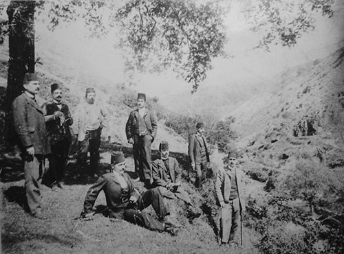
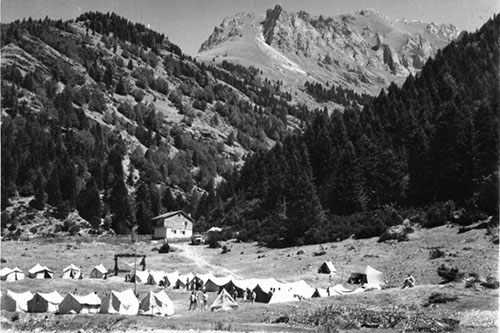
The establishment of the Mountaineering Society “Ljuboten” in 1925 marks the beginning of mountaineering and mountain tourism development on Šar Planina. The first organized hiking tours on Šar Planina began after the establishment of the club. At first, the people were visiting places near the city, but later they started climbing peaks that were far-away from their home. The organized hiking tours in the mountain became very popular in the middle of the 30’s, which is why the first mountaineering infrastructure were built in that same period. The first mountain hut in Macedonia was built in 1931 on Šar Planina, above the beech forest below the peak of Ljuboten, on 1965 meters above the sea level
The first mountain hut in Macedonia, Ljuboten – 1931
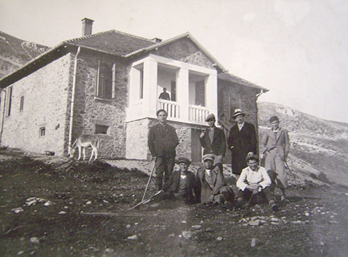
The first mountaineering-ski hut in Macedonia was built on Šar Planina in 1934, after discovering the ski terrains on the mountain. This hut was renovated during 1937/38, which led to the accommodation capacity increasing from 30 to 120 beds. The first ski section was formed in 1929 within the Mountaineering Society “Ljuboten”, and in February 1934 were organized the first ski competition events on Popova Shapka. In the period before Second World War there were many interesting and significant activities on Šar Planina that represent the first mayor steps towards the mountaineering as a hobby and the mountain tourism of Šar Planina as we know it today.
Popova Shapka – 1939
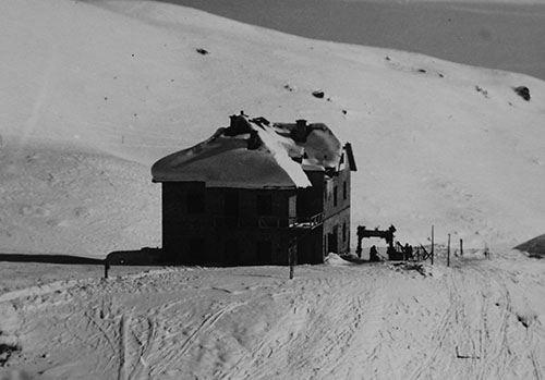
The period after Second World War was important because of all the achieved goals that were set during the 30’s. More people began visiting the mountain, which led to organizing numerous mountain tours. Popova Shapka became a developed ski-center. The ruined mountain huts in Ljuboten and Popova Shapka were re-built and renovated and the first cable-cars and ski-lifts were built on Popova Shapka. The only ski jumping hill in Macedonia was built in 1948. The first Šar Planina Ski Cup was organized in 1947 and represents the oldest ski manifestation in the Balkans. In the meantime, many other objects were built on several locations on Šara, such as the mountain huts on Jelak, Leshnica and Tri Vode, the private houses on Piribeg, Crn Vrv, above Titov Vrv and Dzinibeg, and of course, the symbol of the mountaineering in Macedonia - the tower on Titov Vrv (2747 m), the highest peak on Šar Planina.
Leshnica – 1954
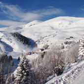
All these projects that satisfied the criteria of the European mountain centers made the 1950s significant years for Šar Planina. Popova Shapka, Jelak. Leshnica, Tri Vode and Ljuboten became tourist attractions in the 60’s and 70’s. New dirt roads (off roads) were built to the tourist destinations and various paths were marked to some of Šara’s destinations. The biggest investments on Šara, however, began in the 80’s, which made Popova Shapka number one ski center in the region. The number of visits, either from domestic or foreign tourists, increased. The scientific visits were of great importance as well, especially those intended for exploring Šar Planina’s biodiversity and endemism.
Šar Planina’s different names
The toponyms, names of regions, peaks and places on Šar Planina are mainly of Slavic origin, although there are some parts of Turkish origin.
Šar Planina
Dushan Krivokapikj, one of the most passionate researchers of Šara, made most effort to come up with a name for the mountain. He noticed that the Dechani Archimandrit Sava described the mountain as “snowy whiteness, green grass, gray stones and diverse trees.” The French traveler tand researcher, Ami Boue, gives an explanation about the name, pointing out the relief and plant diversity, using the name “Šar” (Diverse) and completely dismissing the Turkish names used until then, such as “Šarlag” and “Chardag”.
However, the name Šar Planina has more recent origin (dates from the written documents in 1980, where, apart from names like “Skaradus” and “Monte Argentaro”, there were names with domestic or Turkish origin, like “Šar”, “Šara Planina”, “Šarta”, “Šarlag” and “Chardag”).
The ancient Greeks and Romans knew about Šar Planina as well; the Greek historian Polybius mentions the name “Skardos” for the mountain, and Livie speaks about “Skordie Montis” and “Skardus”.
Jovan Cvetikj explains that up until the 16th century the mountain was known under the name “Skardus”. Another name appears after the 16th century - “Monte Argentaro”, which is replaced by Šar Planina in the 19th century. According to some studies, the name “Šar” derives from the name “Skard” (Skardus in Latin).
Šar Planina – 1950
Popova Shapka
According to legends told for generations, the name Popova Shapka (The Priest’s Hat) was also one of the names for Šar Planina. In the past, the Priest and his
companions visited the region that is now Popova Shapka because they believed that it was a sacred place. One day, the weather got so bad, that the wind blew away the Priest’s hat. Since the priest couldn’t find the hat by himself, he ordered his companions to help him, but the weather was so bad that no one managed to find it. Some of the believers thought that the hat was on the hill, but then he realized that the hill itself looked like the priest’s hat. They left the holy place without finding the priest’s hat, but the name Popova Shapka (The Priest’s Hat) remained ever since.

Popova Shapka – 1955
Titov Vrv
This is how Šar Planina’s highest peak, Titov Vrv, got the name:The peak is located in the interior of the massif. Near Titov Vrv there are two other slightly lower peaks - Mal Turchin (2702 m) and Bakardan (2700 m). The oldest name for Titov Vrv is Turchin Planina. This name was given by the people coming from Gostivar. During the Ottoman Empire, the people from Macedonia were on good terms with some of the Turkish officers. However, that didn’t last long. Everything has change when the law came into force. Since the weather on the mountain (especially on Titov vrv) was inconsistent, the people from Gostivar, who could easily see the peak from their homes, named this place Turchin Planina (Turkish Mountain) because it reminded them of the mercurial personality of the Turks. During and after Second World War the peak was given the name Golem Turchin, and the other two peaks
near Golem Turchin were named Mal Turchin and Bakardan, their current names. The name Golem Turchin remains until 21.04.1953, when by decision of the Council, the peak is renamed into Titov Vrv, its current name.
Titov Vrv – 1954