
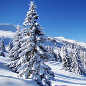
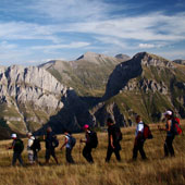
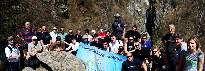
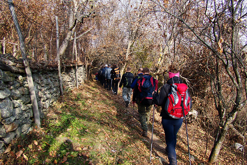
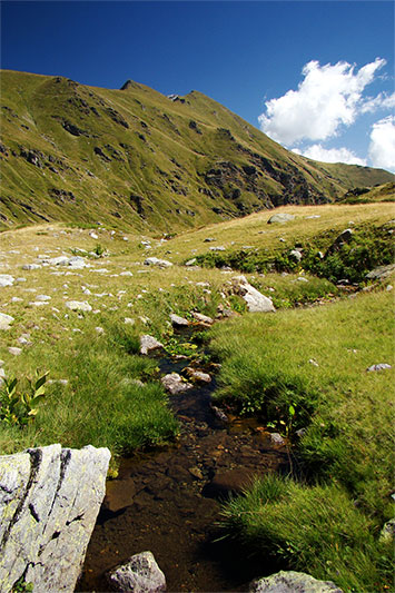
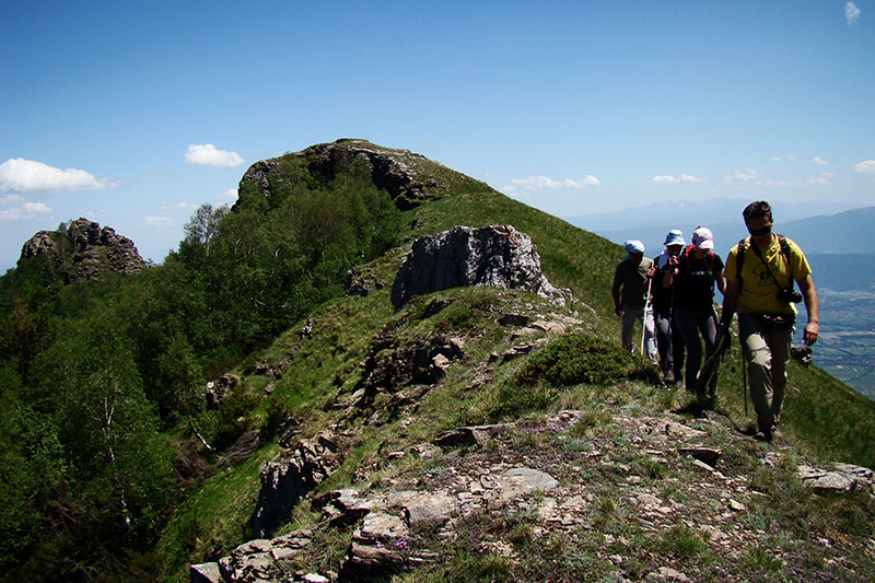
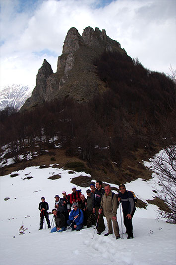
Hiking trails
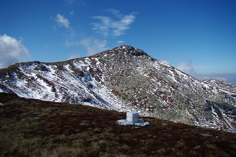
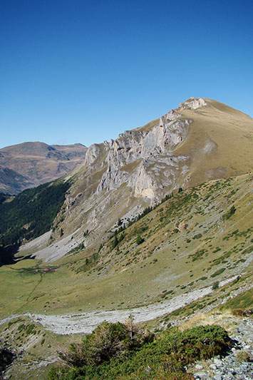
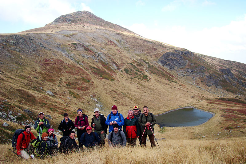
Hiking trail: village Staro Selo - Mountaineering hut Ljuboten - the peak of Ljuboten
This is a fully marked trail that starts from the informative board in the village Staro Selo. It is an interesting, medium hard trail that gives the visitors possibility to enjoy in the breathtaking view of the western part of Shar Planina (Livadichko Ezero, Polog, Skopje and the part in Kosovo from Uroshevac to Shtrpce.
- Specific points: village Staro Selo 900 m.a.s.l. - Mountaineering hut Ljuboten 1630 m.a.s.l.- the peak of Ljuboten 2499 m.a.s.l.
- Total length: 11 km
- Total time: 4:30 hours
- Information: fully marked trail that traverses a forest terrain and continues on pasture and rocky terrain. There is water only in the first part of the trail.
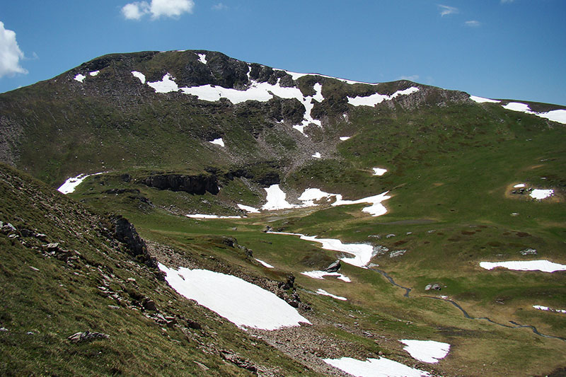
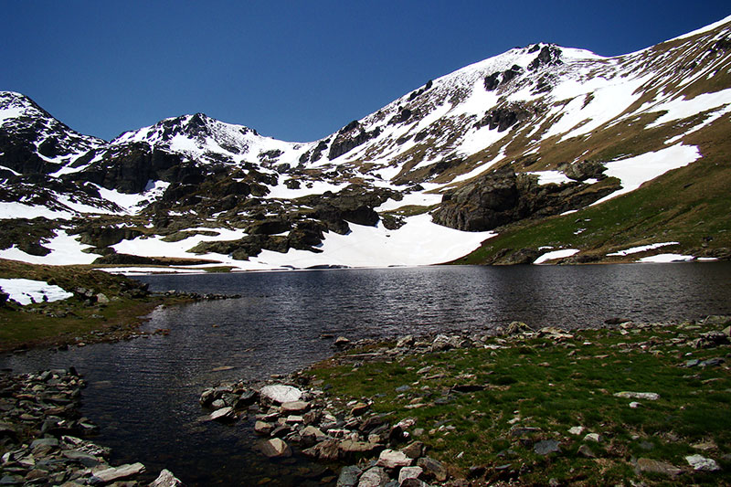
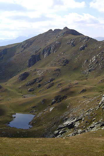
Hiking trail: Mountaineering hut Ljuboten – Kozja Stena – Livadichko Ezero
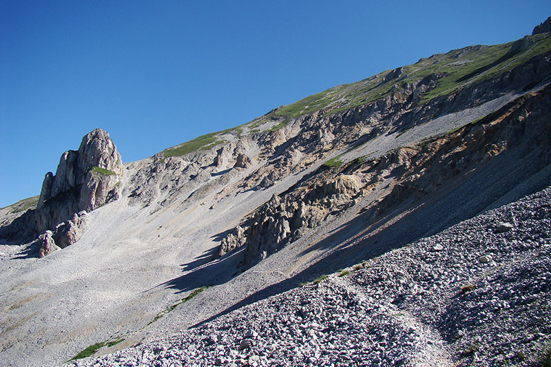
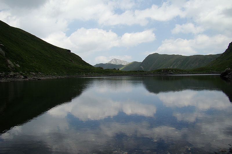
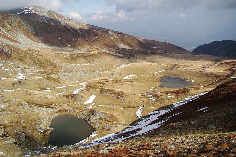
This is a fully marked trail. It is possibly the most exciting trail of them all because it crosses three mountain relief landscapes. It is a medium hard hiking trail that starts from the MH Ljuboten and traverses the biggest rocky talus in Macedonia, above the peak of Ljuboten and passes through the specific rock Kozja Stena. It continues to the top ridge of Shar Planina and from there it descends to the forth out of 25 biggest lakes on Shara, the lake Livadichko Ezero.
- Specific points: MH Ljuboten 1630 m.a.s.l. – Kozja Stena 2100 m.a.s.l. – Livadichko Ezero 2210 m.a.s.l.
- Total length: 7 km
- Total time: 4 h
- Information: hiking trail traversing pasture and rocky terrain. There is water at Kozja Stena and the springs above Livadichko Ezero.
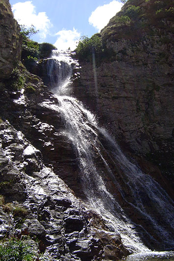
Hiking trail: village Belovishte – waterfall Belojshki Vodopad
This is a fully marked trail that starts from the informative board in the village Belovishte. It is a light hiking trail with exciting end. At the end of the trail there is a rock that requires more attentive descending and gives an opportunity for the hikers to enjoy in the view of the big waterfall Beljoshki Vodopad. Recommended hiking period is the period between April and May, when the vegetation is not that exuberant and the waterfall is rich with water.
- Specific points: village Belovishte 750 m.a.s.l.– waterfall Belojshki Vodopad 1300 m.a.s.l.
- Total length: 3 km
- Total time: 2:30 h
Hiking trail Livadica
This hiking trail is not marked. It starts from the picnic site Petachko Vodiche above village Belovishte. Starting from the parking space on the picnic site, there is an old dirt road that traverses a forest landscape and crosses the southern slope of the ridge of Livadica and descends towards Polog Valley. After crossing the forest, the trail traverses the former meadow sheepfolds and leads to the mild ridge of Livadica, which leads to the peak of Livadica. The peak is also mild and offers a wonderful view of the ski-center Brezovica. There is a breathtaking view of Livadichko Ezero after a slight descent in direction towards the peak of Ljuboten.
- Specific points: Petachko Vodiche 875 m.a.s.l.– the peak of Livadica 2514 m.a.s.l.
- Total length: 10 km
- Total time: 4:30 h
- Information: unmarked trail traversing forest and pasture terrains. There is water only in the first part of the trail, until reaching the ridge.
Hiking trail: village Jeloshnik – Dobroshki Vrv – lakes Dobroshki Ereza - Ezerski Vrv
Not marked, medium hard trail. To the village Jeloshnik there is a paved road. From the village to the sheepfolds Jeloshnichki Bachila there is an hour and a half of walking on a dirt road that leads to the peak Dobroshki Vrv. At the peak Dobroshki Vrv there is a magnificent view of Ljuboten, Piribreg, Ezerski Vrv, Chaushica, Bistrica, up to Crn Vrv. The trail descends towards the lake Gorno Dobroshko Ezero, which is smaller but more abundant with water than Dolno Dobroshko Ezero. From there, in 30 minutes climbing the peak Ezerski Vrv is reached (wild rocky peak, surrounded by large silicate rocks and blocks). The peak offers magnificent view of Piribreg and the wonderful lake Jazhichko Ezero and Chaushica.
- Specific points: village Jeloshnik 890 m.a.s.l.– Dobroshki Vrv 2355 m.a.s.l.– lakes Dobroshki Ereza 2325 m.a.s.l.– Ezerski Vrv 2580 m.a.s.l.
- Total length: 10 km
- Total time: 5:30 h
- Information: unmarked trail. Starting from the village Jeloshnik to the end of the forest, there is a dirt road leading to a pasture terrain, following a slope that leads to Dobroshki Vrv, Dobroshki Ezera and Ezerski Vrv. There is water in the forest and the springs above Dobroshki Ezera.
Hiking trail: Tri Vode
It is a marked trail that starts from the informative board in the village Tearce. Through the village Brezno, the trail leads to the picnic site Tri Vode and goes back to the village Leshok. This hiking trail is considered as mild trail. The picnic site is an excellent camping centre and a starting point for numerous destinations, such as Bistrica, Ezerski Vrv, Chaushica, Crn Vrv and Kuchbaba.
- Specific points: village Tearce 550 m.a.s.l.– village Brezno 970 m.a.s.l.– Tri Vode 1340 m.a.s.l.– village Leshok 610 m.a.s.l.
- Total length: 16 km
- Total time: 5 h
- Information: marked trail traversing a forest landscape. There is water everywhere.
Hiking trail: village Leshok – Tetovsko Kale
This is a marked hiking trail traversing numerous villages of Shara. It starts from the informative board at the monastery complex in village Leshok.What is interesting about this trail is that it can also serve as a trekking trail, especially during the harvest period of the year in the nearby villages. The trail finishes at the famous fortress Tetovsko Kale, which dates back from 1820.
- Specific points: village Leshok 610 m.a.s.l.– village Varvara 815 m.a.s.l.– village Otunje 900 m.a.s.l – village Setole 975 m.a.s.l.– village Gjermo 1075 m.a.s.l.– village Lavce 805 m.a.s.l.- Tetovsko Kale 803 m.a.s.l.
- Total length: 14 km
- Total time: 4:30 h
- Information: marked hiking trail connecting all of the above mentioned villages. There is plenty of water in the villages and a chance to start a pleasant conversation with the local people.
Hiking trail: Bistrica
It is an unmarked hiking trail crossing the third biggest river valley on Shar Planina, through the flow of river Bistrica. It starts from the picnic site Tri Vode. This vivid hiking trail passes through the canyon of Tearechka Bistrica between Chaushica and Suva Dupka and finishes with Crn Vrv. One third of the trail is in a forest and then through a rocky landscape the trail leads to pasture terrains. The pasture terrains lead to the springs of river Bistrica and from there you can climb the ridge of Shar Planina. Starting from that point you can reach the peaks Chaushica, Crn Vrv and Bistrica.
- Specific points: Tri Vode 1340 m.a.s.l. – springs of river Bistrica 2320 m.a.s.l. – the peak Bistrica 2580 m.a.s.l.
- Total length: 13 km
- Total time: 4:30 h
- Information: unmarked hiking trail traversing forest and pasture terrains. There is water along the entire trail.
Hiking trail: Brezjanski Kule
This is a marked hiking trail that starts from the village Varvara. there is an informative board near the church complex St. Petka, with information about the most hiking trails that start from this village. There are two trails leading to Brezjanski Kule - the choice is yours. The other part of the trail traverses a pasture terrain and finishes with a slight clamber to Brezjanski Kule. Although not a high peak, Brezjanski Kule offers a wonderful view of the valley of river Leshochka Reka and the Polog Valley on one side, and the middle flow of river Bistrica with the ridge Chaushichki greben, Ezerski Vrv and Dobroshki Vrv on the other.
- Specific points: village Varvara 815 m.a.s.l.– Brezjanski Kule 1949 m.a.s.l.
- Total length: 9.5 км.
- Total time: 4 h
- Information: marked hiking trail traversing forest and pasture terrains. There is water along the entire trail.
Hiking trail: Tetovsko Kale – Dupnat Kamen
This is an unmarked medium hard mountaineering trail, with an exciting end. It starts from the informative board set in Tetovsko Kale, it continues through a forest above Tetovo and it finishes at Dupnat Kamen (a big rock with huge hole in the middle). There is a magnificent view from the top of the rock of the middle part of Shar planina (from Crn Vrv, Kobilica, Vrtop up to Karanikola and the mountain villages Vejce Brodec and Veshala).
- Specific points: Tetovsko Kale 803 m.a.s.l. – Dupnat Kamen 1904 m.a.s.l.
- Total length: 12 km
- Total time: 4:30 h
- Information: unmarked hiking trail traversing forest terrain, apart from the last 200 meter of pasture and rocky terrain. There is water only on two points along the trail.
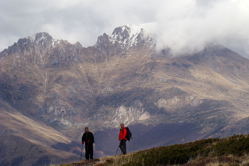
Hiking trail: Crn Vrv
The hiking trail Crn Vrv starts from the village Vejce. It is an unmarked trail and it belongs to the medium hard trails. Right at the start of the trail there is a slope that gives an impression of a steer trail. However, after a short climbing, the trail continues through a ridge and pasture terrain. After 4-4:30 hours of walking, the trail reaches Crn Vrv, the most remote peak where the moving direction is changed, from northeast to southwest.
- Specific points: village Vejce 1065 m.a.s.l. – Crn Vrv 2595 m.a.s.l.
- Total length: 8 km
- Total time: 4:30 h
- Information: unmarked hiking trail traversing pasture terrains. There is water at the beginning of the trail and on the nearby sheepfolds.
Hiking trail: village Brodec – Kobilica
This is an unmarked trail and it belongs to the medium hard hiking trails. It starts from the village Brodec. The first third of the trail crosses through a dense beech forest, the second third traverses the mild pastures and the last third is the hardest, following the ridge of the peak Kobilica. The dominance and the breathtaking view on the peak Kobilica is what makes this peak attractive for the hikers. Looking in northeast-southwest direction, you can see Crn Vrv and Chaushica on one side and Titov Vrv and Leshnichki Karpi on the other. If, however, you look in southeast - northwest direction, you will see the biggest cities under Shar Planina - Tetovo and Prizren.
- Specific points: village Brodec 1050 m.a.s.l.– Kobilica 2528 m.a.s.l.
- Total length: 9 km
- Total time: 4:15 h
- Information: unmarked hiking trail. The first part of the trail leads through a forest, and the other parts through pastures. There is water on the sheepfolds, at the end of the forest.
Hiking trail: village Brodec - Vrtop – village Veshala
This is an unmarked hiking trail, passing through the middle part of Shara’s ridge. It starts from the village Brodec and the first third of the trail crosses a dense beech forest, whereas the other passes through mild pastures. The trail passes by the right side of the peak Kobilica and the rocks of Treskavec and leads to the pass Ljubinski Ushi. From this point the path continues to the peak Shilidze and after a slight descent leads to the peak Vrtop. The peak Vrtop offers a magnificent view of Polog and Prizren Valley. Exceptional is the view of the valley Lechnichka Dolina. The trail continues towards Shara’s ridge until the pass “Shar”, where the old road from Tetovo to Prizren is. Starting from that point, the trail descends to the village Veshala.
- Specific points: village Brodec 1050 m.a.s.l.– Shilidze 2485 m.a.s.l.– Vrtop 2563 m.a.s.l.– village Veshala 1245 m.a.s.l.
- Total length: 22 km
- Total time: 8:30 h
- Information: unmarked hiking trail. The first part of the trail passes through a forest and the other through pastures. There is water on the sheepfold at the end of the forest and on places below 2200 m.
Hiking trail: Popova Shapka – Jelachki Crn Vrv
This is a marked mild hiking trail. It starts from the informative board set in the center of Popova Shapka. It passes through the ruined hut of Jelak and it continues through the pine forest until the peak Jelachki Crn Vrv. This trail is interesting because it is located near Popova Shapka. It is a mild trail and it passes through a coniferous forest. It finishes with a small ridge, which is not considered as safe. There is a magnificent view from to peak of the central part of Shar Planina, from Dupnat Kamen, Crn Vrv, Kobilica, Karanikola, Skakalo, Leshnichki Karpi up to Titov Vrv.
- Specific points: Popova Shapka 1700 m.a.s.l.– Jelak 1850 m.a.s.l.– Jelachki Crn Vrv 1870 m.a.s.l.
- Total length: 5 km
- Total time: 2 h
- Information: marked hiking trail. The first part leads to the pastures above Popova Shapka, and the second one passes through the pine forest of Jelak. There is water at the ruined hut of Jelak.
Hiking trail: Popova Shapka – Gorna Leshnica – Leshnica
This is a marked, medium hard and the most vivid trail on Shar Planina. It starts from the informative board set in the center of Popova Shapka. It passes above the MH Jelak, leading to the sheepfold Ceripashinsko Bachilo. From there it continues to Plat and descends towards Gorna Leshnica. The view along the entire trail makes it the most vivid trail on Shar Planina. After reaching Plat, Vardarishte, Jelachki Crn Vrv and Kobilica are left behind, and the profile of Titov Vrv, Sredna Leshnichka Karpa, Gorna Leshnica with the waterfall Gornoleshnichki vodopad emerge in front. After descending Gorna Leshnica, the trail leads to the great so called Gornoleshnichki canyon, which passes through Plat (first Leshnichka Karpa) and finishes at Leshnica.
- Specific points: Popova Shapka 1700 m.a.s.l.– Gorna Leshnica 1780 m.a.s.l.– Leshnica 1450 m.a.s.l.
- Total length: 14 km
- Total time: 4 h
- Information: marked hiking trail traversing a pasture terrain and a forest. There is plenty of water along the trail.
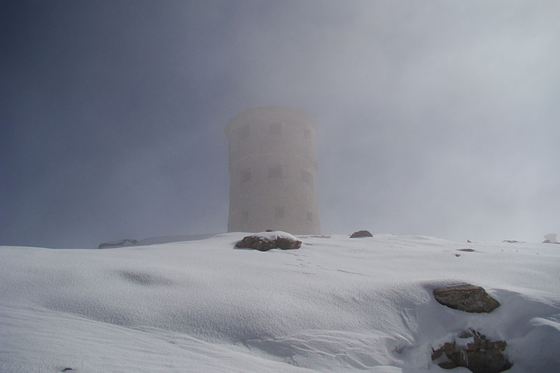
Hiking trail: Popova Shapka - Titov vrv
It is a marked medium hard hiking trail, starting from the informative board in the center of Popova Shapka. This trail is a challenge for everyone who is fond of high peaks. The trail traverses the pasture terrains of Vakuf, Kazani and the peak of Bakardan. On the peak of Titov Vrv (2747 m), there is a 9.30 m tall and 55 years old stone tower. When the weather is nice, one can see the whole massif in front of him, starting from Ljuboten, Piribreg, Chaushica through Kobilica, Karanikola, Klech, Dzinibeg, the dominant peak Borislavec, Vraca up to the peak of Radika. The mountains Korab, Bistra, Krchin and Pelister and Solunska Glava are also visible from Titov Vrv. When the weather is really good, one can also see Rila and Prokletie.
- Specific points: Popova Shapka 1700 m.a.s.l.– Vakuf 2000 m.a.s.l.– Titov vrv 2747 m.a.s.l.
- Total length: 12 km
- Total time: 4 h
- Information: marked hiking trail passing through a pasture terrain. There is water on the place called Kazani.
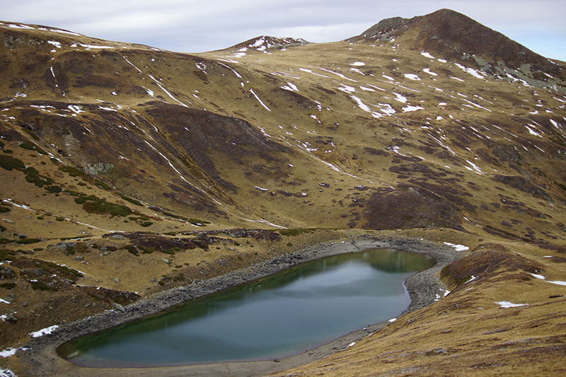
Hiking trail: Popova Shapka – Lake Bogovinsko Ezero
It is a marked medium hard hiking trail, starting from the informative board in the center of Popova Shapka. The trail crosses Vakuf and passes by Golema and Mala Smreka. Though dull at the beginning, after the river Slapska Reka, the trail becomes more vivid and interesting. It finishes with the biggest glacial lake on Shar Planina, the lake Bogovinjsko Ezero. On 1960 m and an area of 66.880 m2 you can see the biggest mirror of Shar Planina in front of you, surrounded by the dominant peak of Borislavec on one side, Smreka on the other and the cirque of Trapeznica, Chelepino and Rudoka around it.
- Specific points: Popova Shapka 1700 m.a.s.l.– Vakuf 2000 m.a.s.l.– Bogovinjsko Ezero 1960 m.a.s.l.
- Total length: 16 km
- Total time: 5 h
- Information: marked hiking trail passing through a pasture terrain. There is water on several places, where the small rivers are.
Hiking trail: Leshnica – Lake Karanikolichko Ezero
It is a marked medium hard hiking trail, starting from the informative board in Leshnica. In the first part, the trail traverses the beech forest of Babaasanica and continues to the river flow of Skakalichka Reka. From there it continues to Sheremetnica. Looking in southern-southwestern direction, one will have the opportunity to see the three grandiose rocks Leshnichki Karpi and the highest peak of Shar Planina, Titov Vrv, in the background. After the pass between Shermetnica and Karatash the trail continues to a mild lawn and leads to the lake Karanikolichko Ezero. On an altitude of 2180 m and an area of 26.240 m2 emerges the third biggest lake on Shar Planina, the lake Golem Gjol. Golem Gjol is a lake that attracts the attention of the visitors no matter the time of the year, due to the changing color of its water.
- Specific points: Leshnica 1450 m.a.s.l.– Karanikolichko Ezero 2190 m.a.s.l.
- Total length: 7.5 km
- Total time: 3 h
- Information: marked hiking trail passing through a forest and pasture terrain. There is water on the point where the trail passes by the river Skakalichka Reka and on the springs above and beyond the lake.
Hiking trail: Leshnica – Lake Skakalichko Ezero
This is a marked medium hard hiking trail starting from the informative board in Leshnica. the first part, the trail traverses the beech forest of Babaasanica. If you look in the direction of Leshnica, you will be able to see the three rocks Leshnichki Karpi. The trail crosses the river Skakalichka Reka next to the waterfall Skakalichki Vodopad, which in spring time is abounds with water. After a short climbing, a small “tamed” lake emerges in front of you. This lake is one of the highest lake on Shar Planina, on 2340 m and the cirque of Skakalo.
- Specific points: Leshnica 1450 m.a.s.l.– Skakalichko Ezero 2340 m.a.s.l.
- Total length: 7 km
- Total time: 3:30 h
Hiking trail: Leshnica – Dzinibeg – Krivoshija
This is a marked medium hard hiking trail starting from the informative board in Leshnica. Starting from Leshnica, the trail passes by the river Pena flow and leads to Dzinibeg. There are many wild goats throughout the trail. Following the trail towards the river Pena, you will pass by the third Leshnichki Kamen and arrive to Krivoshija. You cannot stay indifferent after witnessing the view in front of you - the middle Leshnichka Karpa sharply cut and Titov Vrv behind it. You continue descending to the lake Krivoshisko Ezero and follow the river flow of Krivoshiska Reka, reaching the waterfall Krivoshiski Vodopad and passing the great canyon of this river, between the second and the third Leshnichka Karpa.
- Specific points: Leshnica 1450 m.a.s.l.– Dzinibeg 1980 m.a.s.l.– Krivoshisko Ezero 2250 m.a.s.l.– Krivoshiski Vodopad 1870 m.a.s.l.– Leshnica 1450 m.a.s.l.
- Total length: 16 km
- Total time: 7:30 h
- Information: marked hiking trail with a wonderful view. There is water along the entire trail.
Hiking trail: Krivoshiski Vodopad and Kadi na Krivoshija
This is a short, interesting and vivid trail passing through the second and the third Leshnichka Karpa. It is a marked trail and it starts from Leshnica continuing to the river flow of Krivoshiska Reka. Going towards the Krivoshiski Vodopad you traverse the left shore of the river Krivoshiska Reka and pass between the second and the third Leshnichka Karpa. You cannot stay indifferent after witnessing the magnificent view of the high and steer rocks, mixed pine and beech forest and Titov Vrv. We recommend that you visit the so called Kadi na Krivoshija, but be attentive when walking by the slippery rocks around the small waterfalls. This is a nice tour for those who want to enjoy in Shar Planina’s natural values.
- Specific points: road Leshnica 1450 m.a.s.l.– Kadi na Krivoshija 1575 m.a.s.l.– Krivoshiski Vodopad 1870 m.a.s.l.
- Total length: 5 кkm
- Total time: 2:30 h
- Information: Marked trail that traverses forest terrains. There is water along the entire trail.
Hiking trail: Crno Ezero
This is an unmarked mild hiking trail that requires transportation by a jeep. The trail starts from the village Negotino and continues on a dirt road that leads to the border house Mazracha and through a lawn to Borislavec itself. Climbing Borislavec on its left side, you reach the deepest (11 m) and second biggest (33.520 m2) lake on Shara. At an altitude of 2122 m, this lake is the only lake that doesn’t have a round form. The lake amazes with the wilderness of its cirque and the rocky part of the hill Crnoezerski Rid on its left side.
- Specific points: road Sharski Vodi 1400 m.a.s.l.– Crno Ezero 2122 m.a.s.l.
- Total length: 6 km
- Total time: 2:30 h
- Information: Unmarked hiking trail. It traverses the pasture terrains on the left side of Borislavec. There is water around the lake.
Hiking trail: Golema Vraca
It is an unmarked hiking trail that belongs to the hard mountaineering tours. Climbing this peak is very interesting because it represents one of the last high peaks on Shar Planina and it is the furthest southern part of the mountain. It starts from the water capture of the river Mazdracha. In the first part, the trail traverses a forest landscape, than it continues to the ridge of Vraca, which is a pasture landscape. The last part of the trail is a rocky landscape. After reaching the summit, there is a wonderful view of the plateaus Shutman, Gorno and Dolno Lukovo Pole.
- Specific points: roadSharski Vodi 1400 m.a.s.l.– Golema Vraca 2590 m.a.s.l.
- Total length: 8 km
- Total time: 4:30 h
- Information: unmarked hiking trail passing through a forest and pasture terrains. There is water in the first third of the trail.
Hiking trail: Mala Vraca
This is an unmarked hiking trail that starts from the road Sharski Vodi at the water capture of river Mazdracha. It is an interesting hiking trail passing through the foothill of Golema Vraca, continues to its right side towards the lakes Vrachanski Ezera and leads to the pass between Golema and Mala Vraca, where the lake Gorno Vrachansko Ezero is located. Starting from the lake, the trail continues to the peak of Mala Vraca, which is the steepest part of the trail. These 350 meters are truly demanding, but the end is exciting and rocky. There is a magnificent view of Shutman, Gorno and Dolno Lukovo Pole and Golema Vraca from the peak of Mala Vraca.
- Specific points: roadSharski Vodi 1400 m.a.s.l.– Dolno Vrachansko Ezero 1995 m.a.s.l.– Gorno Vrachansko Ezero 2203 m.a.s.l.– Mala Vraca 2540 m.a.s.l.
- Total length: 8 km
- Total time: 4 h
- Information: unmarked hiking trail passing through a forest and pasture terrains. There is water up until the lake Gorno Vrachansko Ezero.
Hiking trail: The peak of Radika
This is an unmarked hiking trail that starts from the road Sharski Vodi at the pass of river Mazdracha. It starts from the foothill of Vraca and continues along the flow of river Mazdracha. The valley of Mazdracha is the fourth biggest valley on Shar Planina. The trail passes through the left flow of river Mazdracha and crosses the sheepfolds of the valley. At the upper flow of river Mazdracha, the trail turns to the right, leading towards the lakes Radichki Ezera, small perennial lakes located above the peak of Radika. Starting from that point, the trail continues to the peak of Radika, after 170 meters of climbing. Looking in direction towards West, you can see Gorno and Dolno Lukovo Pole and the place between them where the spring of river Radika is.
- Specific points: roadSharski Vodi 1400 m.a.s.l.– lakes Radichki Ezera 2226 m.a.s.l.– the Peak of Radika 2405 m.a.s.l.
- Total length: 8 km
- Total time: 5 h
- Information: unmarked hiking trail trasvering a forest and pasture terrains. There is water up until the upper lake.
Hiking trail: village Debreshe - Ramen Kamen (Crn Kamen)
This is a marked hiking trail of recreational character. The trail from the village Debreshe to Ramen Kamen is primarily a footpath that can be also used for mountain biking and mountain running, as well as snow shoeing and ski mountaineering during the winter. The total length of the trail is 8 km, with total denivelation of 1230 meters.
- Specific points: village Debreshe 900 m.a.s.l.– Ramen Kamen 1900 m.a.s.l.
- Total length: 8 km
- Total time: 4 h
- Information: fully marked hiking trail trasversing a forest terrain. There is water at the beginning of the trail.
Hiking trail: village Dolno Jelovce - Ramen Kamen (Crn Kamen);
This is a marked trail from the village Dolno Jelovce to Ramen Kamen. Same as the previous trail, it is primarily a footpath that gives opportunity for a wider aspect of touristic-recreational and sport activities in summer and winter conditions. It is 7 km long, with a denivelation of 850 meters.
- Specific points: village Dolno Jelovce 1060 m.a.s.l.– Ramen Kamen 1900 m.a.s.l
- Total length: 8 km
- Total time: 7 h
- Information: fully marked hiking trail traversing a forest terrain. There is water at the beginning of the trail.
![]()